CATCHMENTS 101
What is a catchment?
A catchment is a large area of land — including hills, streams, lochs, forests, fields, and even urban developments –– which collects rainfall to feed into a river.
NatureScot defines a catchment as “the area of land drained by a river and its tributaries.”
A well, borehole, spring or stream only exists because rainfall from the surrounding catchment supports it.
Example: a catchment map for the Forth River. Image by Forth Rivers Trust 2022.
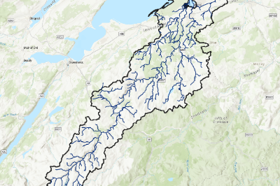
Example: a catchment map for the River Findhorn. Image owner Sean Dugan 2024.
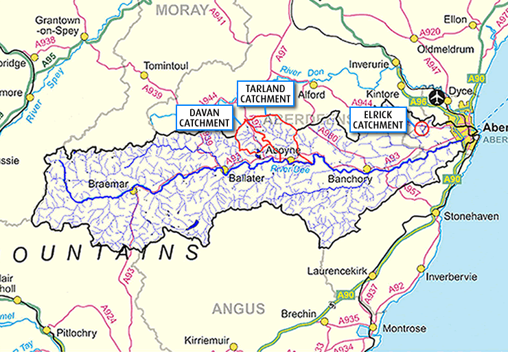
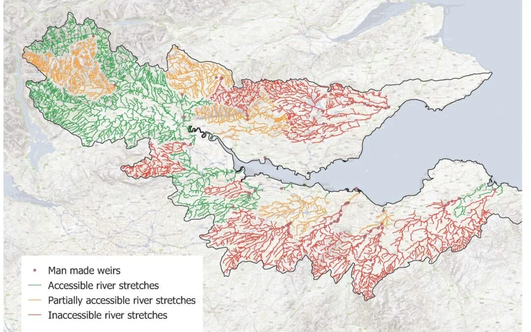
Example: a catchment map for the River Dee. Image by Scottish Natural Heritage 2004, Crown copyright 2004.
Catchments and contamination
A well, borehole, spring or stream only exists because rainfall from the surrounding catchment drains into it.
Therefore, it is important for the catchment responsible for your private water supply – and especially all upstream areas –– to be protected from contamination.
Forestry, agriculture, and construction activities elsewhere in the catchment are common risks to your water supply system. Contamination might go unnoticed, or it might manifest as changes in your drinking water’s appearance, taste or odour:
Microbiological contamination might occur from septic tanks, livestock, wildlife, or spreading slurry.
Chemical contamination might occur from fuel spillages or the spraying of pesticides or fertiliser.
Physical contamination might occur from erosion or soil run-off, or conversely, from stagnating or flooding water.
Protecting your catchment
Pollution related issues:
Farming & Water Scotland is a Scottish Government programme delivered by SRUC and SEPA, which works with land managers within SEPA’s own ‘Diffuse Pollution Priority Catchments’: those are the catchment areas already identified by SEPA as failing to meet environmental standards due to human activity.
A map of SEPA’s diffuse pollution priority catchments can be found here: https://www.farmingandwaterscotland.org/diffuse-pollution/scotlands-priority-catchments-what-to-expect-from-a-priority-catchment-inspection/
Meanwhile, in catchments considered by Scottish Water to be one of their ‘Drinking Water Protected Areas’, they run a Drinking Water Protection Scheme where they will consult land managers regarding any planned activities within or near the drinking water protected area, and follow up to review water quality issues. A map Scottish Water’s drinking water protected areas can be found at the following link, categorised as either surface water or groundwater: https://www.gov.scot/publications/drinking-water-protected-areas-scotland-river-basin-district-maps/
If you have questions about the Scottish Water scheme, you can email: protectdwsources@cottishwater.co.uk According to Scottish Water’s webpage, you could alternatively call their Customer Helpline 0800 0778 778 and ask to speak to a member of the Sustainable Land Management team.
Scarcity related issues:
SEPA is the first point of call regarding any sort of water scarcity concern in your catchment, including where a local burn might be behaving abnormally. You can report any scarcity concerns to SEPA via email: lowflowimpacts@sepa.org.uk
Anything else:
The Drinking Water Quality Regulator in Scotland has produced a two-tier risk assessment for catchment hazards, based on their proximity to a private water supply abstraction point: those within a 50-metre radius, and those within a 250-metre radius. Your local authority’s Environmental Health team could conduct this risk assessment if you raise your concerns with them.
Certain areas have formed catchment management initiatives to connect those interested in a specific catchment, and to produce and deliver a catchment-wide management plan. It might be useful to find out if there is an existing partnership near you which could help address or escalate any concerns you might have.